
USA -(Ammoland.com)- “I’m still mapping more and more every day!” says angler and mapmaker, Mike Gogal. “In the past, I always used maps for my fishing adventures and have amassed a huge collection. Today, they’re just getting harder and harder to find”
Facing that challenge, Mike decided in late 2014 to sit down at his computer and start mapping America’s streams. His approach was novel to say the least.
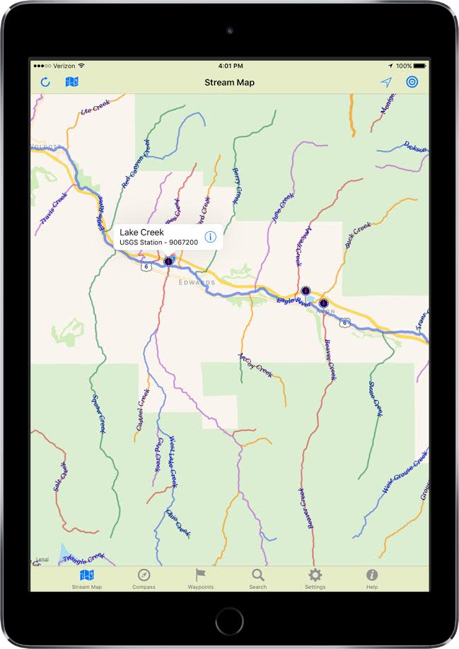
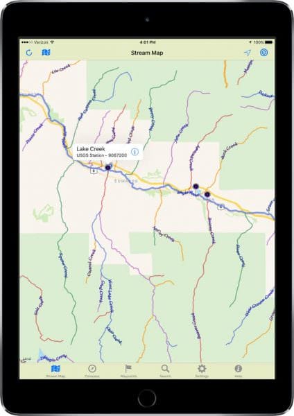
“I wanted to abandon the traditional blue lines of old, and map each stream in a unique color to make it easier to find and follow on a map. Any tributary would simply be colored differently. As I looked at the preliminary results, I realized these maps could really be something.”
Today, Mike operates Gogal Publishing Company, a mapmaking firm specializing in unique outdoor maps designed for iPhones, iPads, and Android devices.
His signature product, Stream Map USA, is a series of 8 regional apps that cover every stream in the lower 48 U.S. states.
“It’s been two and a half years of hard work but as of today, I’ve finally completed the set and am launching Stream Map USA’s North Central edition.”
Now you can explore even the most remote rivers, lakes, and streams. Finding them is simple! Just type in a name and you immediately get turn-by-turn driving directions right to streamside.
Search for any water across the entire region or limit your search by state or even search an individual county. Once you locate your water, simply touch the map to add a waypoint, then tap “Go” for turn-by-turn driving directions right to the water.
Stream Map USA’s searchable color coded maps can be viewed over roadmaps, satellite images, or high resolution topographic maps. It even includes USGS Stream Gauge markers that provides instant access to current water conditions through the US Geological Survey’s National Water Information Service.
Once you arrive, Stream Map USA turns your mobile device into a handheld GPS. Your location is displayed on the map as it follows your travels. Along the way, you save additional waypoints with GPS accuracy and add your own notes.
This feature is ideal for marking fishing holes, campsites, tree stands, scenic locations, or just about anywhere you may want to return to.
To get back, simply tap your waypoint’s “Target” button and use the built-in navigation compass which points the way and counts down the distance right to your spot. It even works without cellular service.
“Stream Map USA is the culmination of years of work and I’m not stopping here.” said Mike. “I plan to continue improvement to these maps for years to come! It is my hope that these maps will be the “Gold Standard” for outdoor enthusiasts and watershed managers alike.”
Stream Map USA is currently available for purchase on the App Store and Google Play. Each edition is priced at $9.99 and can be installed on multiple devices including both phones and tablets.
For those interested in learning more, visit StreamMapUSA.com or simply search for it on your app store.